
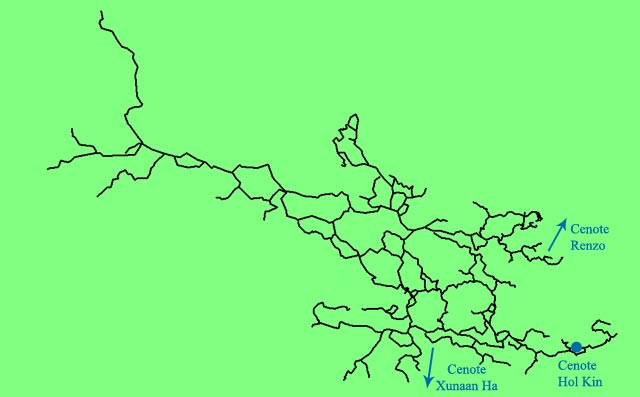
 Hol Kin is a cenote located about 350 meters
North-North-East from the cenote Xunaan Ha and connects to its up-stream, over the classic circuit now
fairly well known.
Hol Kin is a cenote located about 350 meters
North-North-East from the cenote Xunaan Ha and connects to its up-stream, over the classic circuit now
fairly well known.
This section of the system, which has the same name as its main entrance, extends to the northwest for a linear distance of 1.4 km and includes 10,111 meters of underwater caves.
Since I enjoyed this section tremendously during the exploration phase, I decided to make the maps, in the hope that it will be useful for divers who want to visit this cave and, more importantly, to inform the landowners, the local population and government agencies of this great hidden treasure, which is likely to be damaged due to rapid human settlement in the area.
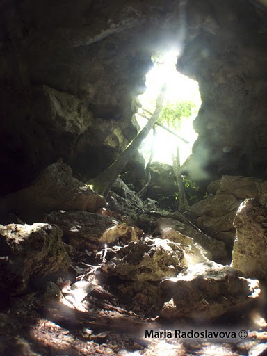
 The hol Kin entrance
- view from the cavern zone -
The first step was to outline the boundaries of the section, thus isolating it from the rest of the system. The parameter I used for this task was finding access point from which I easily could enter this section of the cave.
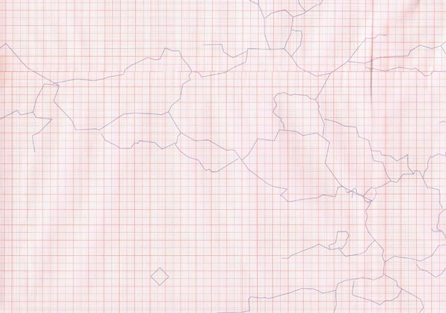
Then I decided on the final size of the map, about 40 cm high and 75 cm wide and I printed on graph paper the horizontal projection of the guidelines.
At this point I resurveyed the cave to take reference points to rapresent the change in all passages and details
such as decorations, columns, breakdowns, floor-to-ceiling distances and the drawing of
certain specific cross sections.
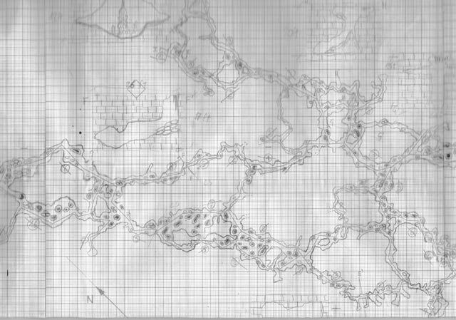
This work required 20 dives with a total of 51 hours and 15 minutes dive time.
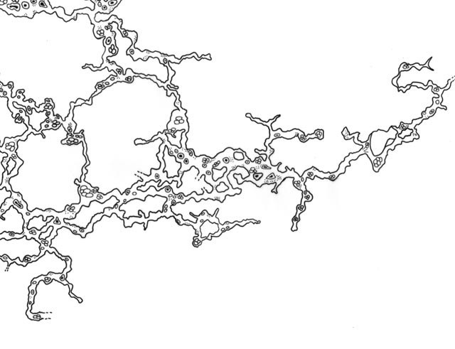
The lateral borders and the details were then retraced in black ink on transparent paper in order to have a clearer picture without distracting elements. Before the introduction of graphic software, this would have been the final draft from which the final map copies would be made.
I further digitized the map with vector graphics software.
I scanned the individual maps in, and was then able to merge them into a larger map. The computer software allowed
me to work on overlaying portions and details, creating a map that can be reduced to a smaller size with great detail
or enlarging it without having a distracting pixel effect.
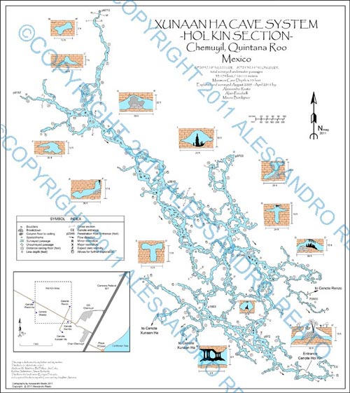
Observing the work so far, I decided to change the orientation of the map with North the top of the map. This changed the final map size but allowed me to add several cross section and additional informations.
Jim Coke, explorer and experienced cartographer of both underwater and dry caves, was a great help in achieving a better result Many thanks to him for his advice and guidance in this project.
The map received an Honorable Mention at the NSS Cartographic Salon 2011 in the "Apprentice" category and is available in the Quintana Roo Speleological Survey selling points.